

We needed to ford a small creek, it was not much at the time, but it was running, and I could see that it could get deeper than I would want to cross…

Then we had to wait for a SUV to come down the hill so we could go up. The photo does not do the road justice. It was bumpy aka slowwww and steep when considering we had our camper on our back.

As we drove up into the sage brush desolate area it was amazing to see the fertile soil down in the valley.

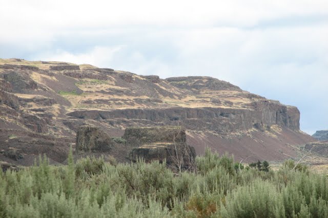
There were cool rock formations sticking up out of the hills.

This rock marked the entrance to the BLM.

We got to a fork in the road and there were cars and people. We talked to some and they told us there is a gate and the campsites are hike in, and there is a waterfall also.

We turned around and found a spot for lunch…

We decided to go to a campsite we camp at on occasion at Banks Lake near Coulee City, WA. We looked at the map and it looked like the road thru Moses Coulee MIGHT go thru where we could connect with US Hwy 2.
Saw a couple of hawks along the way.

At one point we thought the road was ending, it seemed like we were driving into a farmers yard. Turned out it was the end of the coulee, and the road did a S curve passing a few houses then climbing up a steep hill out of the coulee.
If you look close in this shot there is a telephone pole at the top edge of the cliff. The wire follows the steep cliff on the left all the way to the bottom of the valley in the farmers pasture.

No comments:
Post a Comment